On our first day of our trip to Bastogne, we had run across a couple of signs for a Historical Route. One the second day, we decided to drive the route somewhat in order to visit all 15 sites. It was a little difficult because there is no printed map available. Each sign has directions to the next site on the route. That means you have to remember the directions or write them down or something or, like we did, take a digital photo of the directions so you can refer to them on your camera.
Despite the vagueness of the directions, we managed to find all the sites on the same day except for the second one. That one we had to go back and look for on our third day in Bastogne and we finally found it.
So, even though this isn’t the order in which we necessarily saw things, I’ll post photos of the sites in the order in which they appear on the route. Also, some of the sites had little more than the sign to tell you what took place in the area – not really a lot to see at some sites. To explain what happened at each of the sites, I’ll share either the information on the sign with you, or the information from the driving tour brochure we’d gotten from the tourist information office. (The driving tour brochure was for 5 other driving routes – not this Historical Route – but some of the sites overlap on each of the tours overlap.)
Also, all spellings below are as they appear on either the sign or in the brochure. You’ll notice that a lot of words have the British spelling vs. the American spelling, such as “defences” instead of “defenses”.
If you ever do this driving tour, hopefully the photos posted will give you a hint of what to look for in the absence of good directions.
1 – MCAULIFFE SQUARE
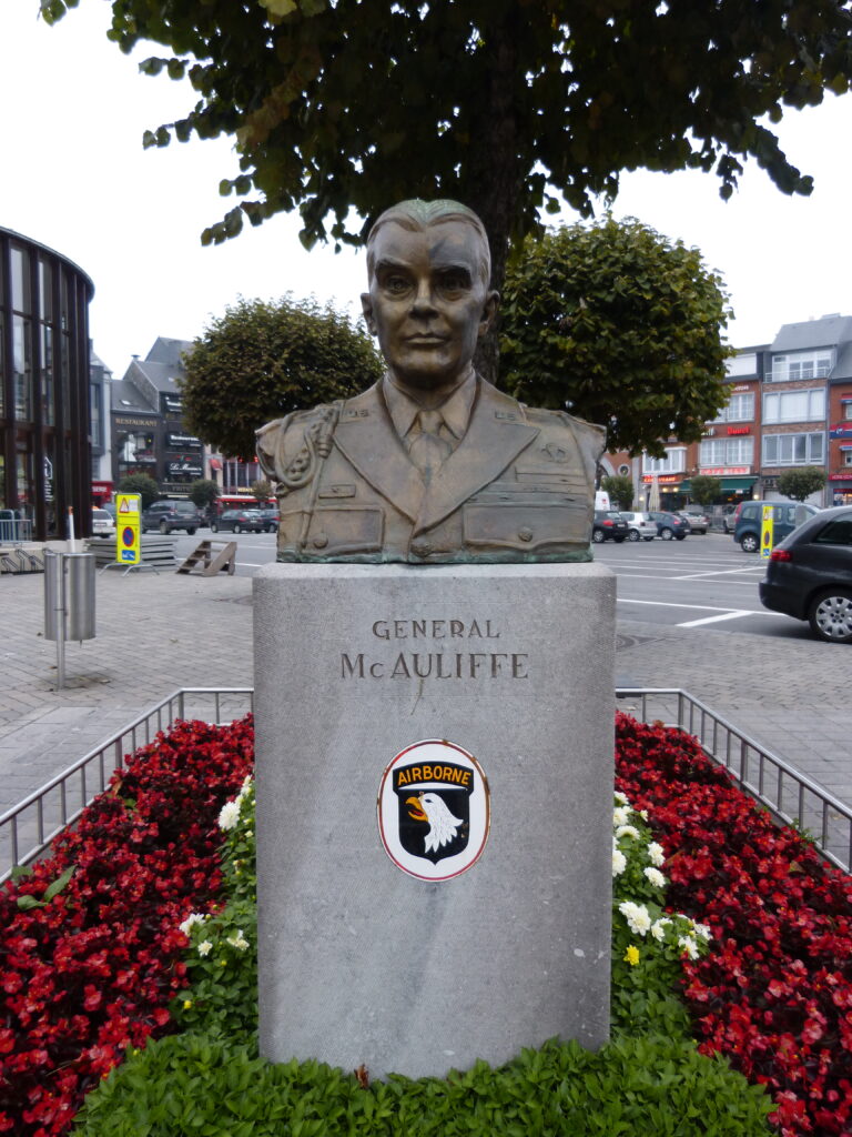
This is the main square in Bastogne, named after General McAuliffe. There is, naturally, a statue of him at the square:
The big attraction at the square is the Sherman tank nicknamed Barracuda.
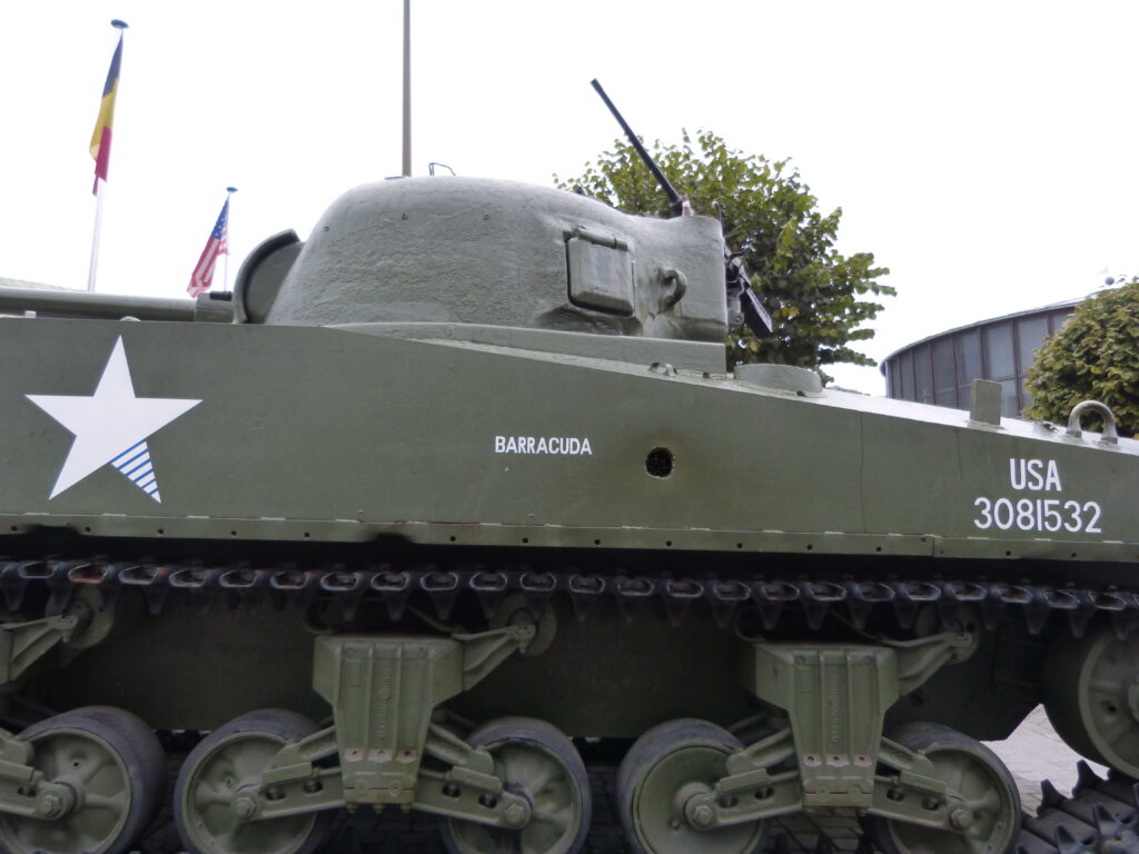
You can see a big hole in the side of the tank where it was hit by a German shell.
2 – NOVILLE
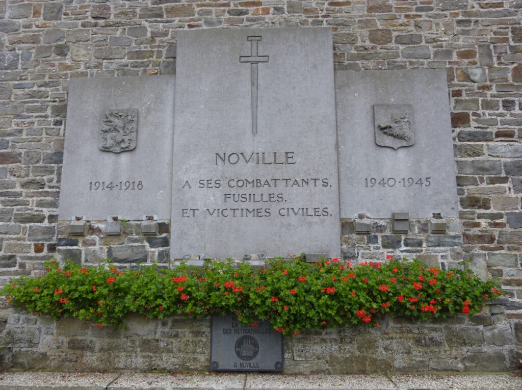
The driving tour brochure says: “On 18 December and throughout the next two days, armoured vehicles of the combat team commanded by Major William Desobry, and the para battalion of Lieutenant-Colonel La Prade, slowed the advance of 2. Panzer and of 26. Volksgrenadier. Seriously wounded Major Desobry was evacuated then taken prisoner by the Germans. Lt-Colonel La Prade was killed during the fighting. The American troops eventually withdrew towards Bastogne and the Germans occupied the village for more than a month.”
The informational sign was near a church, and this monument to both world wars was on the front of the church:
3 – RECOGNE
The informational sign here was right in front of a German military cemetery. There are over 6,000 German soldiers buried here, ranging in age from 16 to 52 years old at their time of death.
Originally there were also American soldiers buried here, but they were later moved either to the U.S. to be re-buried or to one of the American military cemeteries in the area.
You can see in this photo that there are 3 names engraved on the front of the marker:
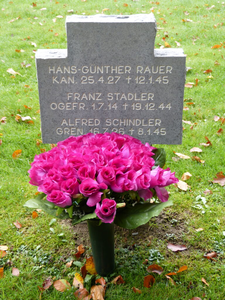
Most of the markers had 3 names on the front and 3 names on the back, meaning there up to 6 burials per plot.
You can also see that the first soldier listed on this marker was killed just 3 months shy of his 18th birthday. The second soldier was 30 years old when he died and the third was 18 years old. (The dates are all written European style, which is date.month.year, so 25.4.27 is April 25th, 1927.)
4 – MAGERET
This was actually the first site we’d run across on our first day of touring. This is the turret of an American Sherman tank and is the first of many that we saw over 3 days.
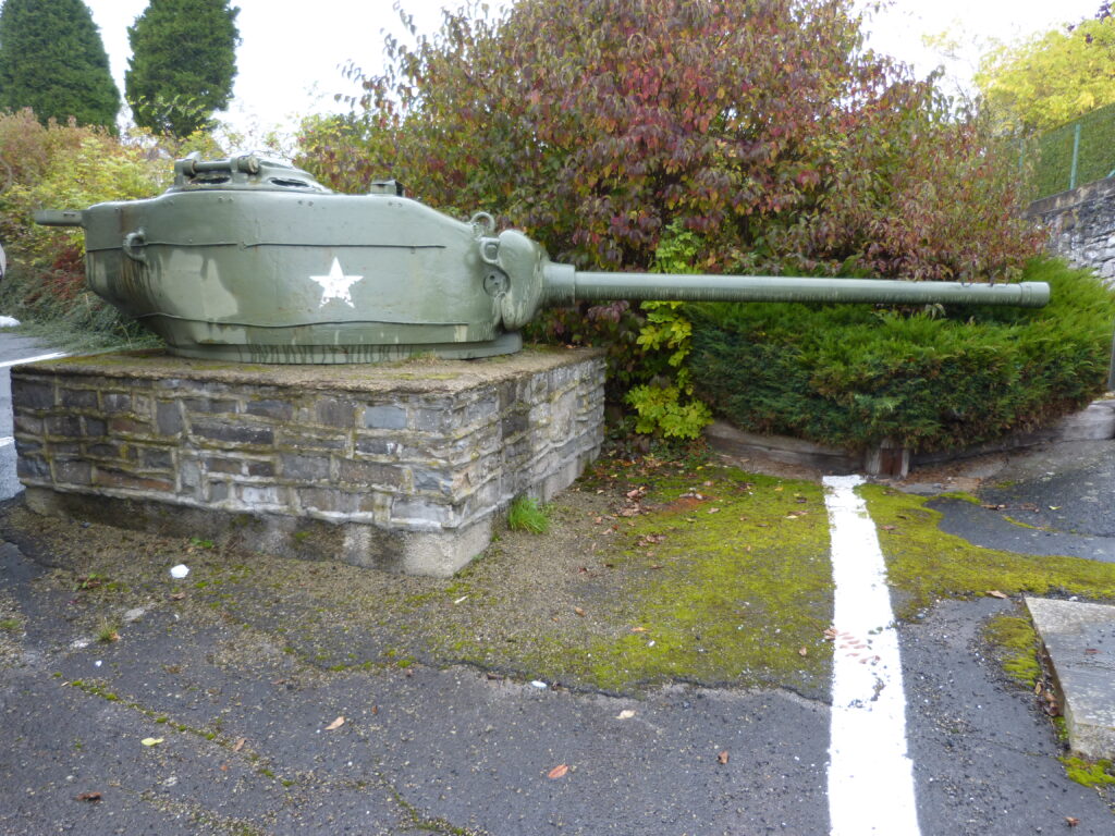
Our driving tour brochure had this to say about the town of Mageret: “Arriving in the village on 19 December at 02:00 hrs, the vanguard of Panzer ‘Lehr’ under the command of General Fritz Bayerlein attacked the roadblocks set-up by Combat Team Cherry. After fierce fighting, 15 German tanks were destroyed but the Americans also lost many armoured vehicles. Although its advance was slowed-down, Panzer ‘Lehr’ did not exploit its advantage to advance towards Bastogne, thus allowing the Americans to strengthen the town defences. The village remained occupied by German troops until 13 January ’45.”
5 – NEFFE
If you read my previous blog on Bastogne, you saw that Sean’s grandfather was stationed in the area in December 1944 and that Sean has a photocopied page from his diary covering 3 dates.
The entry dated Dec 19, 1944 reads, in part: “Taken to main outpost east of Bastogne, east of Neffe”, so we wanted to visit this town anyway.
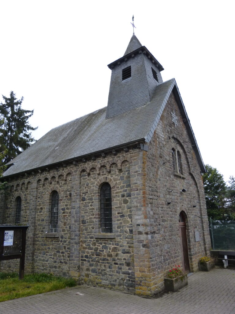
The information sign at this site references the terrible weather conditions and how they complicated the fighting between the two armies. The sign also says “The village of Neffe remained in German hands until January 1st 1945, before being liberated by a group of the 6th Armoured Division U.S.”
Here’s a photo of the chapel in the town of Neffe, next to which the information sign is located:
6 – MARVIE
The driving brochure says this about the town of Marvie: “On 20 December, Panzer ‘Lehr’ maintained its siege of Bastogne, attacked the American paratroopers and armoured vehicles of Combat Team O’Hara, and tried several times to capture the burning village, which they succeeded in occupying. The village was finally liberated on 9 January ’45. Meanwhile, the civilian population had paid a heavy price in lost human lives and in destruction.”
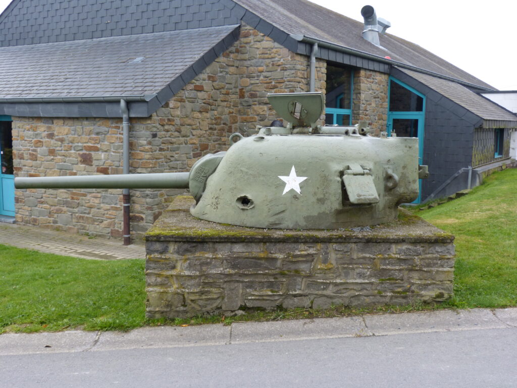
This gun turret was at this site. You can see a hole in the turret where it was damaged.
7 – VILLERS-LA-BONNE-EAU
The information sign here stated: “Occupied on December 19th 1944 by a unit of German parachutists (5th Fallschirm Jäger Division), the village was subjected to a barrage of American artillery fire, which claimed the first civilian victims.”
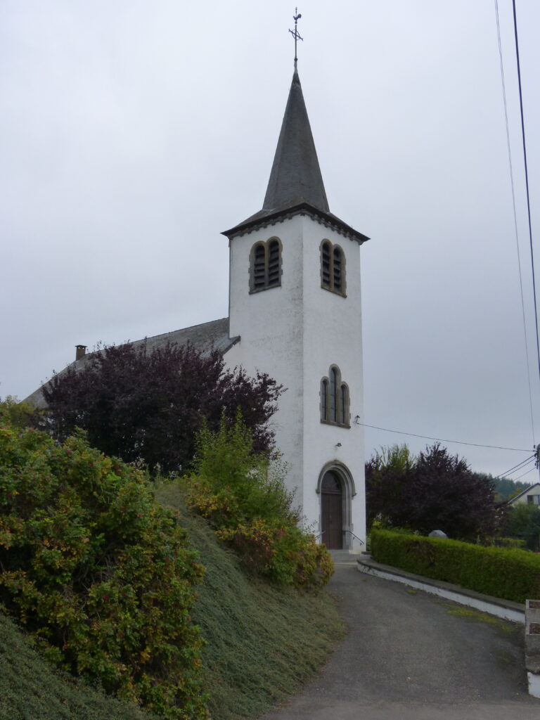
This was the church near the sign in the village of Villers-La-Bonne-Eau:
8 – PLACE MERCENY, BASTOGNE
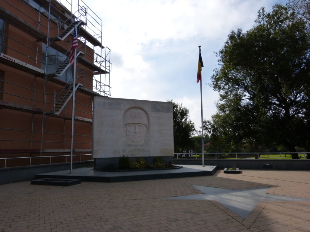
We had a little difficulty locating this site, the Patton monument, as it turned out to be in the corner of a paved parking lot, near a building under scaffolding.
General Patton commanded both the Seventh U.S. Army and the Third U.S. Army during World War II.
In doing a little reading for this blog, I found out that Patton’s final assignment was in Bad Nauheim, Germany. This is the same town where Elvis Presley lived when he was stationed in Germany and we were just there a couple of months ago for the Elvis festival.
Patton died in Germany on December 21, 1945 as a result of injuries sustained in a car accident on December 8, 1945. He is buried in the American cemetery in Luxembourg.
Here is the monument, which was unveiled by Patton’s grandson in 1963:
9 – FORT BOGGESS
This is Sean standing next to a Belgian Army pillbox known as Fort Boggess:
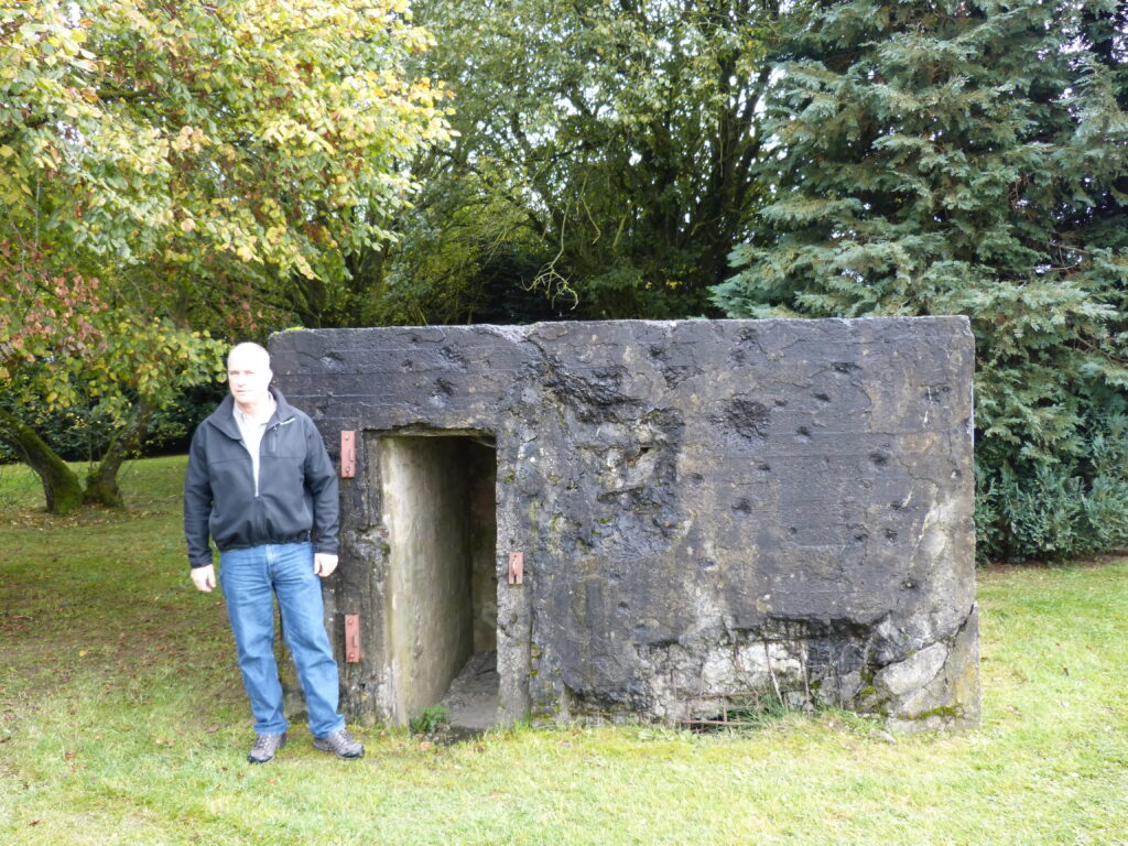
A plaque on the side of the pillbox reads “Here, in the evening of December 26 1944, 4th Armored Division of Patton’s 3rd Army met with 101st Airborne Division thus breaking the encirclement of Bastogne.”
You can clearly see the damage to the bunker from the battle in the photo.
The lead tank on that evening was commanded by Lieutenant Charles Boggess and the pillbox is named after him.
If you want to know more about pillboxes, including how they came to be called that, you can read about them here http://en.wikipedia.org/wiki/Pillbox_(military)
10 – ASSENOIS
This was the second marker we had run across on day one.
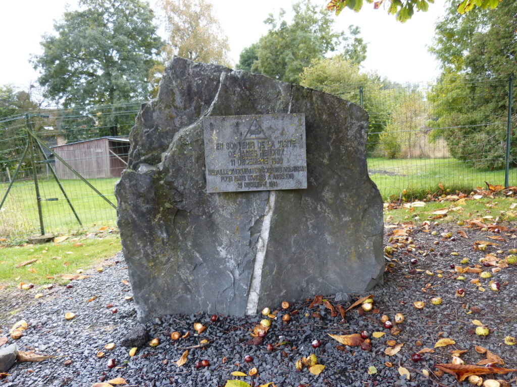
It’s in the town of Assenois, and the plaque on the stone indicates that it’s in memory of the visit of James Hendrix on December 11th, 1999. The plaque also indicates that Private Hendrix was a Congressional Medal of Honor recipient and acknowledges his feats at Assenois on December 26th, 1944. On that date, Assenois was occupied by the Germans and the U.S. Army drove them out.
You can read more about Private Hendrix here http://en.wikipedia.org/wiki/James_R._Hendrix
11 – SENOCHAMPS
From the driving tour brochure: “On the first day of the Battle of the Ardennes, the Americans deployed three battalions of field artillery around the outskirts of the village. On 21 December, the American units were attacked but, with the aid of reinforcements, repulsed the German assault. Over the course of the following days the American troops finally found themselves in the siege zone and abandoned their positions. Nonetheless, on 2 January ’45, they would reoccupy the village.”
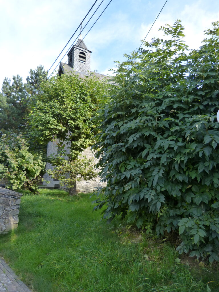
There wasn’t much to photograph here except the little chapel, and there was no really good angle from which to get a good photo, so this was the best I could do:
12 – CHAMPS
While driving the Historical Route, we occasionally saw information signs for another tour.
In the town of Champs, we saw one such sign that said: “The village of Champs was used by the occupying army to launch attacks against the nearby town of Bastogne, where the 502nd Infantry regiment of the 101st Airborne were surrounded and resisting fiercely. The German tanks were destroyed and the fighting ended hand-to-hand in the village, from one house to another, from one cellar to another. Monument inaugurated on October 17 2004 in memory of the victims of these battles.”
Quite a few of the signs we saw mentioned hand-to-hand combat. I can’t even imagine.
Our driving brochure added this information: “After the fighting, the inhabitants discovered a message written in chalk on the blackboard of the local village school by a German officer:
‘May the world never again experience another Christmas night like this! To die in combat far from one’s children, one’s wife and one’s mother, there is no greater cruelty. To take a son from his mother, a husband from his wife, a father from his children – is this worthy of a human being? Life can only be given and accepted so that we can love and respect each other. It is from ruins, blood and death that universal brotherhood will undoubtedly be born.’”
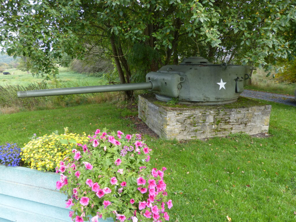
This was the tank turret at this site:
13 – LONGCHAMPS
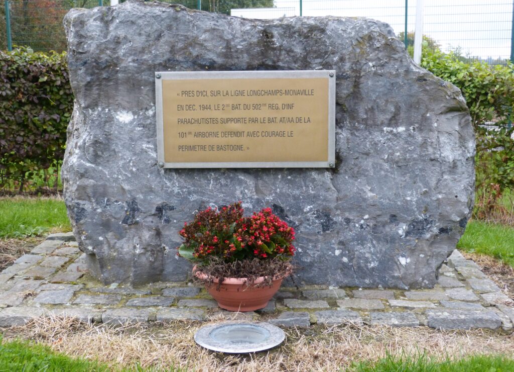
This location also had one of the other (not the Historical Route) signs mentioned above. It read: “The village of Longchamps belonged to the same defence system as Champs, i.e. that is to say that it was allotted to the 502nd parachute regiment under the command of Lieutenant-Colonel Steve A. CHAPPUIS, with, in his line, the 506th Battalion, which defended the perimeter until Foy” and “For two days, the German forces tried to pierce the defences set up by the 502nd regiment, who were well defended by an anti-aircraft regiment and despite sustaining serious casualties, held on. The survivors called this place ‘misery wood’.”
This site had this stone marker with a French sign talking about the courageous defense of the perimeter of Bastogne:
14 – HEMROULLE
The information sign here said: “The village of Hemroulle was one of the only villages to remain in the American zone during the siege of Bastogne.”
In addition, the driving tour brochure said: “On 22 December, following a heavy snowfall, Major John D. Hanlon, commanding the 1st Battalion of the 502nd Parachute Infantry Regiment, asked the villagers for white sheets to camouflage his men and vehicles. After the war, in February 1948, the Major returned to the village to officially present replacement sheets to the population from the people of his hometown, Winchester. In the course of a remembrance ceremony, he was made an honorary citizen by the local authorities. The village of Hemroulle was never occupied by German troops. Hemroulle area was also the DZ (Dropping Zone) for supplies to the besieged units, in Bastogne, on 23 and 24 December.
This is the little town church next to the sign:
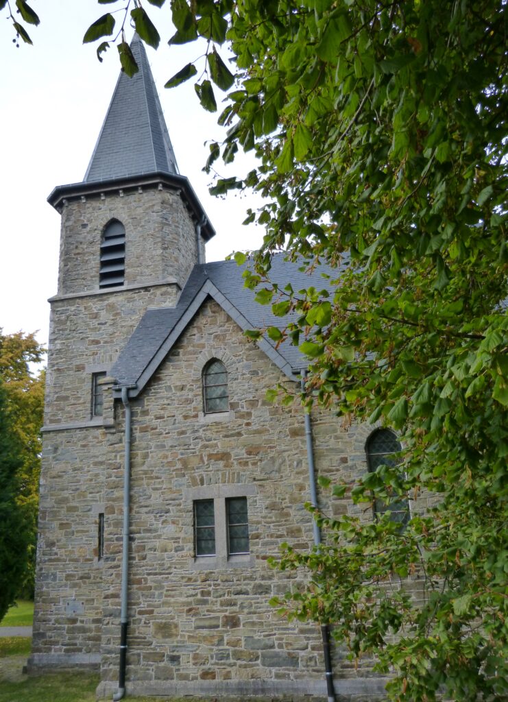
There is a plaque on the side of the church that says this: “This memorial is dedicated to the American paratroopers of the 463rd Prcht. FABn. and to the Belgian people of Hemroulle who with the 463rd made a gallant stand Christmas Day 1944.” (Prcht. is an abbreviation for Parachute and FABn is and abbreviation for Field Artillery Batallion.)
15 – BASTOGNE
These buildings were the Under Lieutenant Heintz Barracks, where General McAuliffe made his headquarters.
They are now called the Bastogne Barracks and there is a museum there.
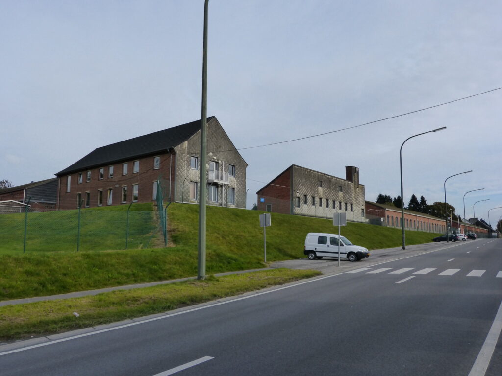
This was the last site on the tour.
Although the lack of good directions was a bit frustrating at times, we still had fun driving around trying to find them and finding other things of interest to check out along the way.

