Among the seemingly endless amazing sights in Germany is the Geyser Andernach, the highest cold-water geyser in the world.
I didn’t even realize that there are both hot-water and cold-water geysers until I found out that Andernach is only about an hour away from us in Germany and read up on it.
We took a drive there one sunny day and went to the Discovery Centre to buy a ticket, which includes a 20-minute boat ride on the Rhine River to get to the geyser. The geyser is located on the Namedyer Werth peninsula, now a nature reserve.
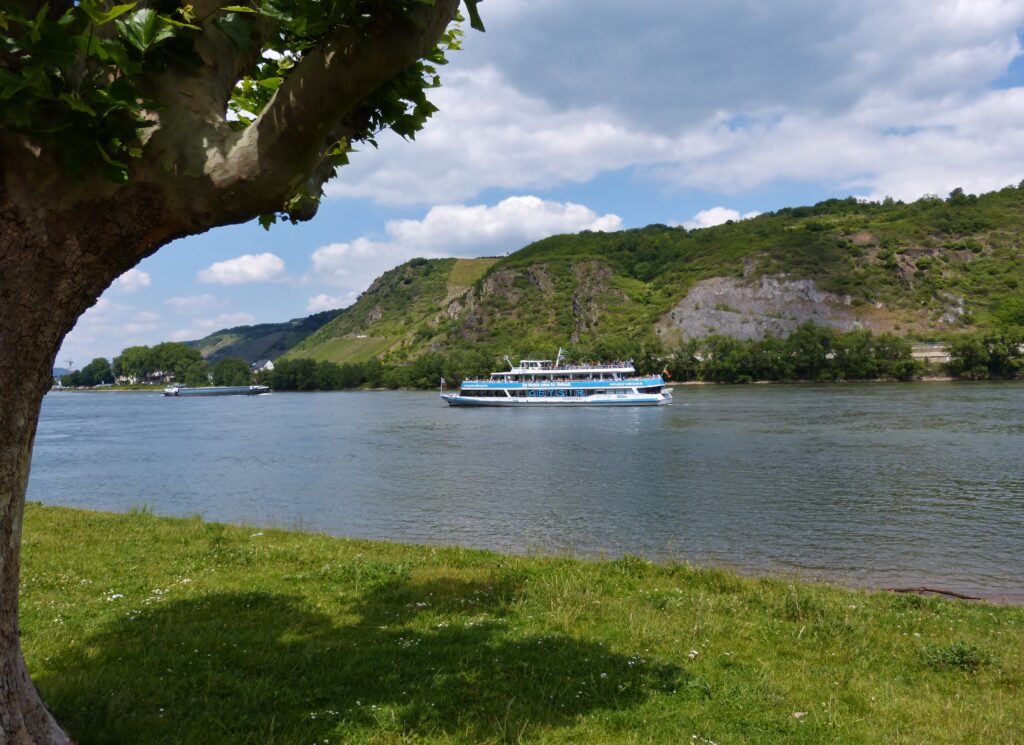
The boat drops you off near the geyser and you have to walk a short distance to get to it.
You know the sound a carbonated beverage makes when you unscrew the bottle top? Well, that’s similar to the sound the geyser makes just before it starts spewing water, only much louder of course. The reason for that is the water eruption is driven by carbon dioxide. A hot-water geyser, on the other hand, is driven by steam.
A few minutes after you hear that sound, the geyser’s height reaches its peak.
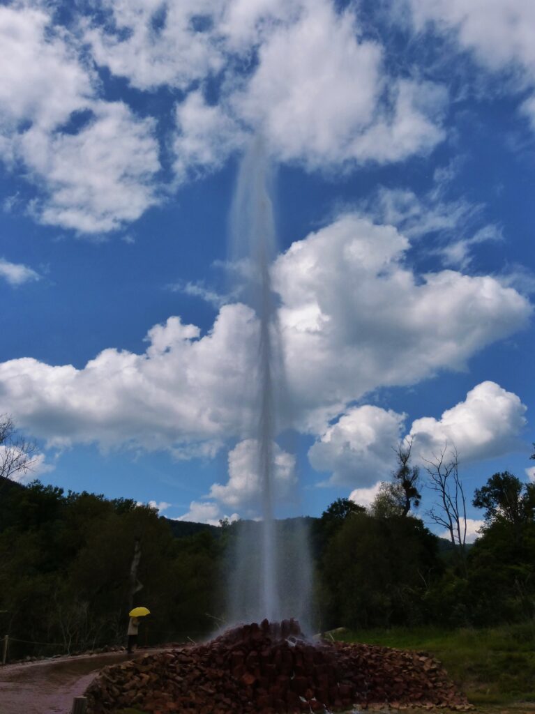
I liked the employee with the yellow umbrella. I felt like I was in an episode of How I Met Your Mother.
Once the geyser starts subsiding, you’re allowed to get closer to it. You can touch the water to feel how cold it is. The guy with the umbrella fills up a bucket with water and you can drink some if you like.
After checking out the geyser we headed back to the boat for the return trip. It’s about 90 minutes from the time you leave Andernach until the time you return, so they give you plenty of time to walk to and from the geyser and to have plenty of time at the geyser itself.
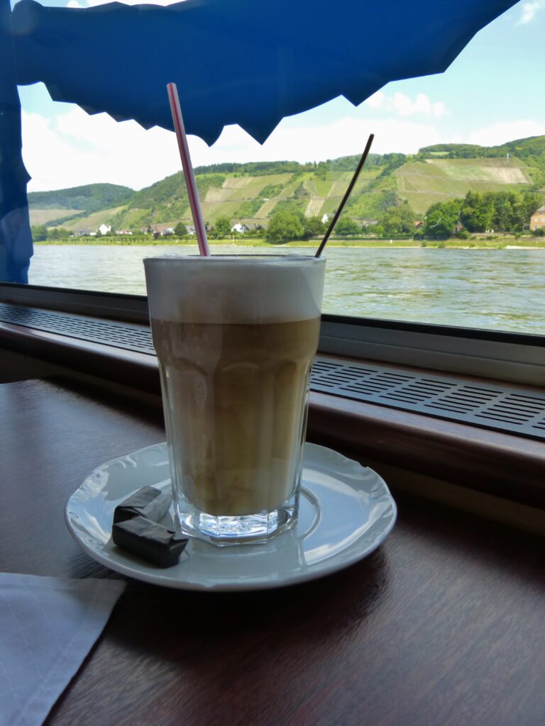
If you’re worried that you might be left thirsty during the boat ride, never fear. They serve beer, wine, mixed drinks, coffee and soft drinks. Germans are never ones to leave you hanging for something to drink, even during a 20-minute boat ride.
For the Tipple of the Day, I stuck with a latte macchiato though.
Back at the Discovery Centre, we went upstairs to the Tourist Information desk to get a walking tour map of the town. Although we didn’t spend any time at the Discovery Centre, there is an exhibition there. If you’re really interested in the workings of cold-water geysers, you may want to make sure you have time for that.
The first sight we ran across was this old crane which is called, appropriately enough, The Old Crane.
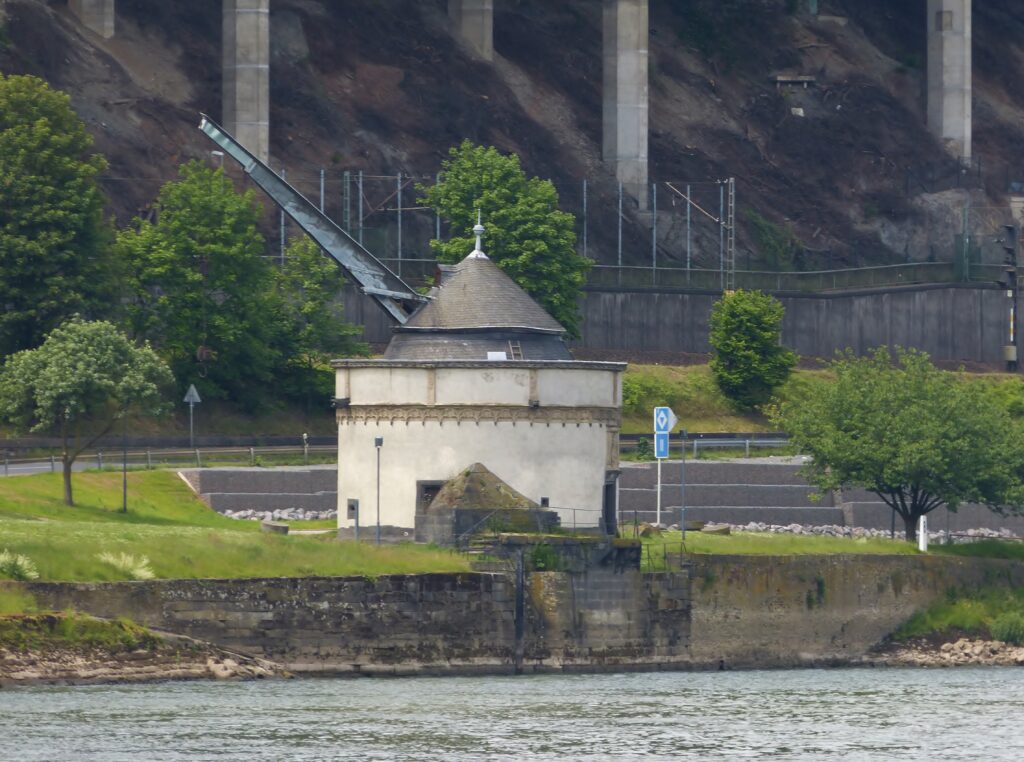
It was built from 1554 to 1561 and its purpose was to move goods produced in Andernach, such as millstones and wine, onto boats on the Rhine for transport. The moveable crane, used until the year 1911, was operated by “crane servants”.
How cute is this?

These birds were walking down the sidewalk, decided to cross the street, and traffic stopped to let them do it. Aw.
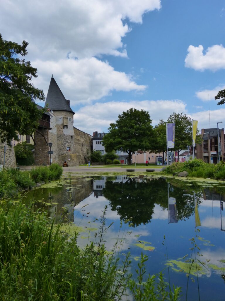
This round tower is called, appropriately enough, The Round Tower.
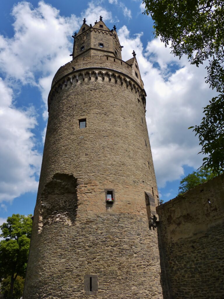
It was built between 1440 and 1453. In 1689, French troops tried to blow it up. You can see the resulting damage, a gaping hole on the left-hand side of the photo. At two different points in the 20th century, the tower served as a youth hostel. It now houses an exhibition, open on weekends during the summer, about its history.
This beautiful church is called, appropriately enough, The Beautiful Church.
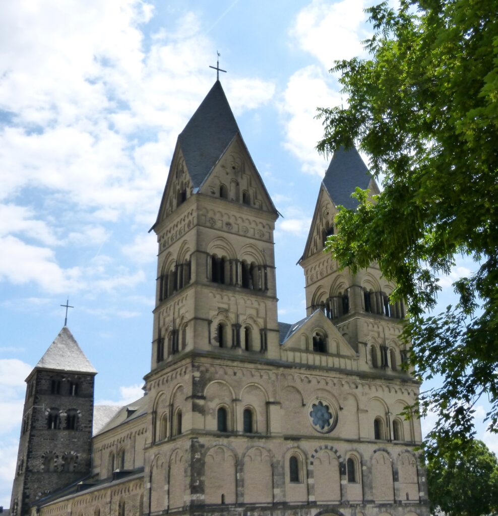
Just kidding. It’s referred to as both the Mariendom and the Liebfrauenkirche, a Catholic church built in the year 1200.
The inside of it was beautiful as well.
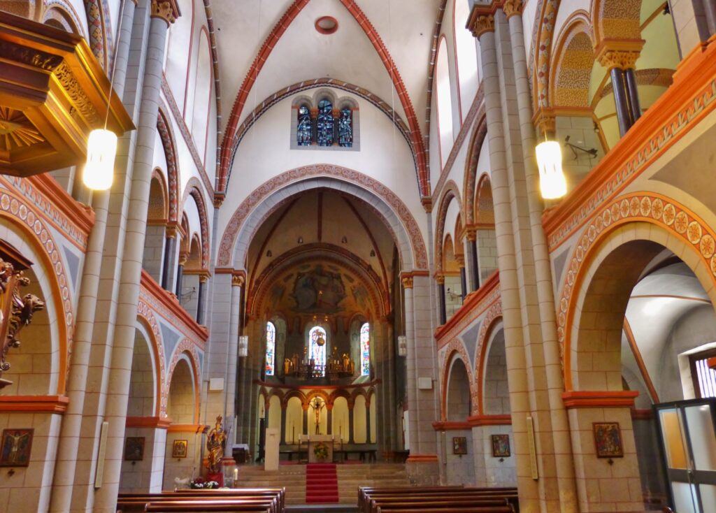
I liked all the different colors around and between the upper and lower arches.
This next tower is called the Helmwartstower.
It was originally part of the town’s defensive walls and was renovated in 1994.
The white building you see here was the town hall.
403
A synagogue formerly stood here. Underneath the town hall there is a mikveh, a bath used in Judaism to obtain or regain ritual purity. The water level in this particular bath rises and falls along with the water level of the Rhine river.
I’ve mentioned in a couple of other blog posts that I’m fascinated with manhole covers.
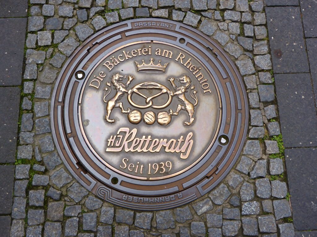
Many of the covers in Andernach were sponsored by businesses. That one is sponsored by a bakery – note the lions holding a pretzel!
Here you see the Christ Church.
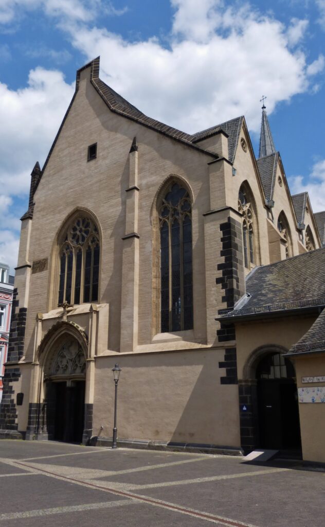
Building was begun on it in 1245 and was not finished until over 200 years later in 1450.
This is called the Läufkreuz.
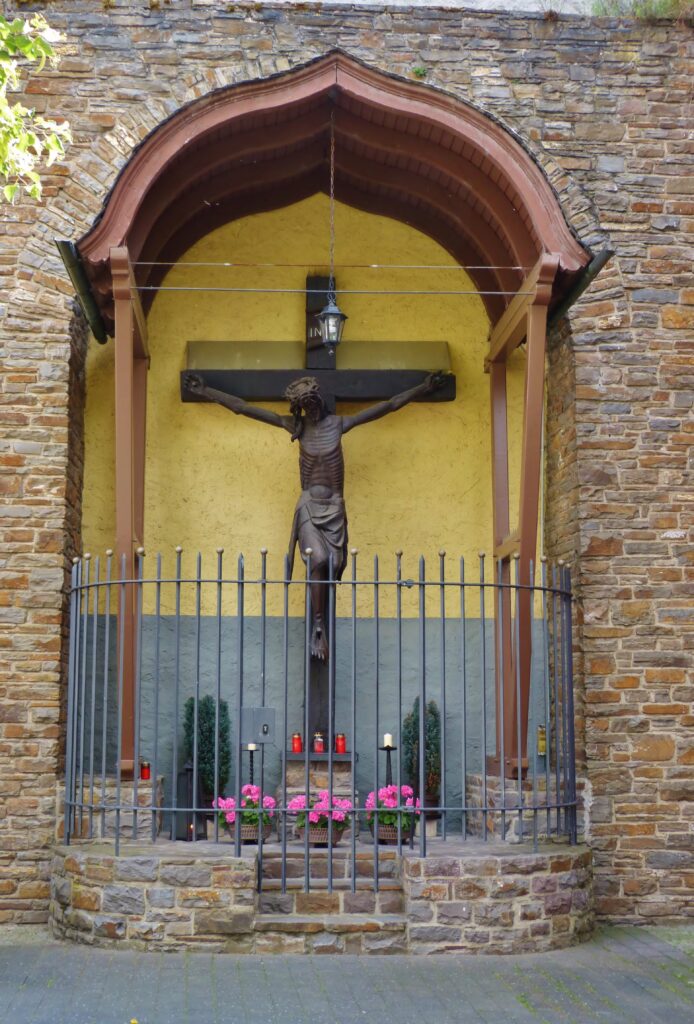
The body on the cross is bigger than life-size and dates from the 14th century. The crucifix was originally located at a municipal hospital that was abandoned in 1841. A sign near the cross said that it was at the burial ground for “wretched souls” from the hospital.
This lovely house was built from 1594 to 1600 and was originally a private residence for a man named Georg von der Leyen. You will not be surprised to learn, then, that it is called The House of Leyen. They didn’t seem to be too fond of coming up with creative names for buildings in Andernach.
The building is now owned by the town and has housed the municipal museum since 1936.
Here you see the town castle of the Archbishop of Cologne.
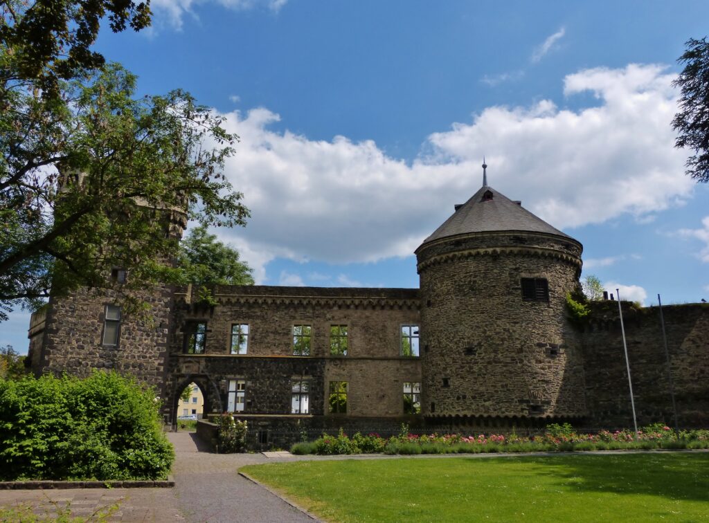
It was built in the 13th century and was used both for residential and defensive purposes. Large sections of the castle complex were destroyed by the French in 1689. You may remember that the Round Tower you saw earlier was damaged by the French in that same year.
This pyramid o’ cannonballs near the castle ruins are from the Thirty Years War.
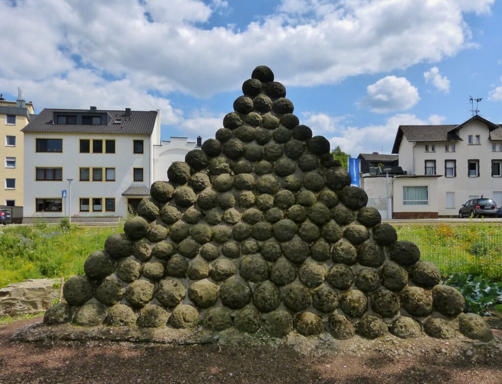
That war took place from 1618 – 1648.
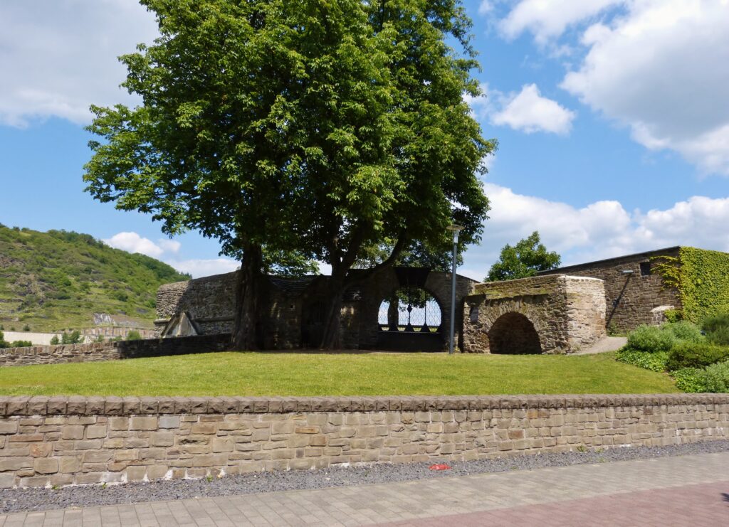
Hopefully you’re not tired of churches yet because there were quite a few of them on this tour.
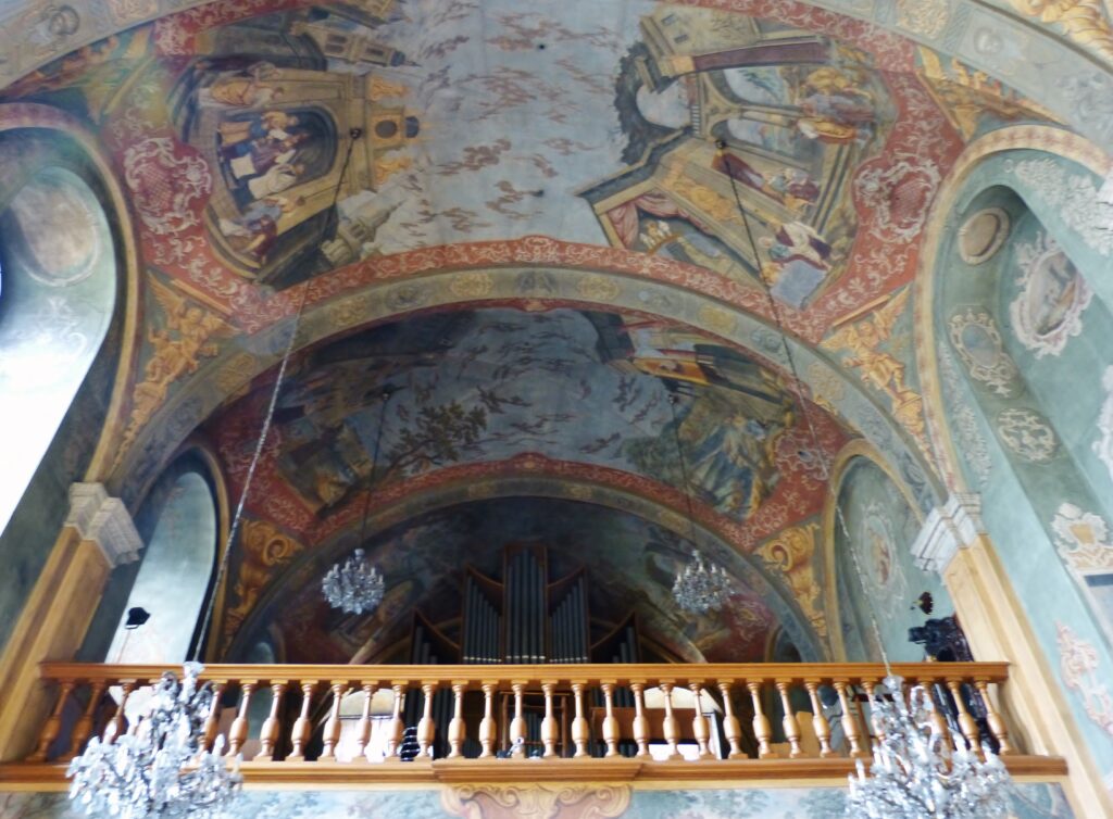
That’s the inside of the Hospital Church, built between 1737 and 1739. The wall and ceiling paintings were fabulous.
At first we thought maybe this thing was a medieval dog house or something.
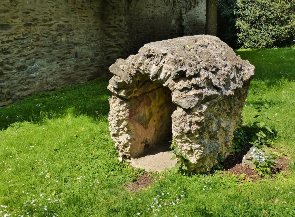
We then noticed it was open on both ends, and we saw a tiny bit of a sign. Unfortunately most of the sign was broken off but from what little we could read we learned it’s actually a Roman water pipe. A little Googling revealed that it was part of the Eifel Aqueduct, one of longest ever built by the Romans. It was constructed in the year AD 80 and carried water to homes, fountains and baths in the city of Cologne. The aqueduct was in use for 180 years. The little section in this photo may be a reconstruction; we couldn’t see enough of the broken sign to find out.
Here we are almost back at the lot where we parked the car.
That structure is called the Bollwerk, which translates to bulwark or bastion. It was built between 1659 and 1661 and at this point on the river a toll was collected for the mucky-mucks in Cologne. There is now a war memorial inside the bastion but unfortunately it was locked up the day we were there.
The last photo of the day is something that has fascinated me in various towns.
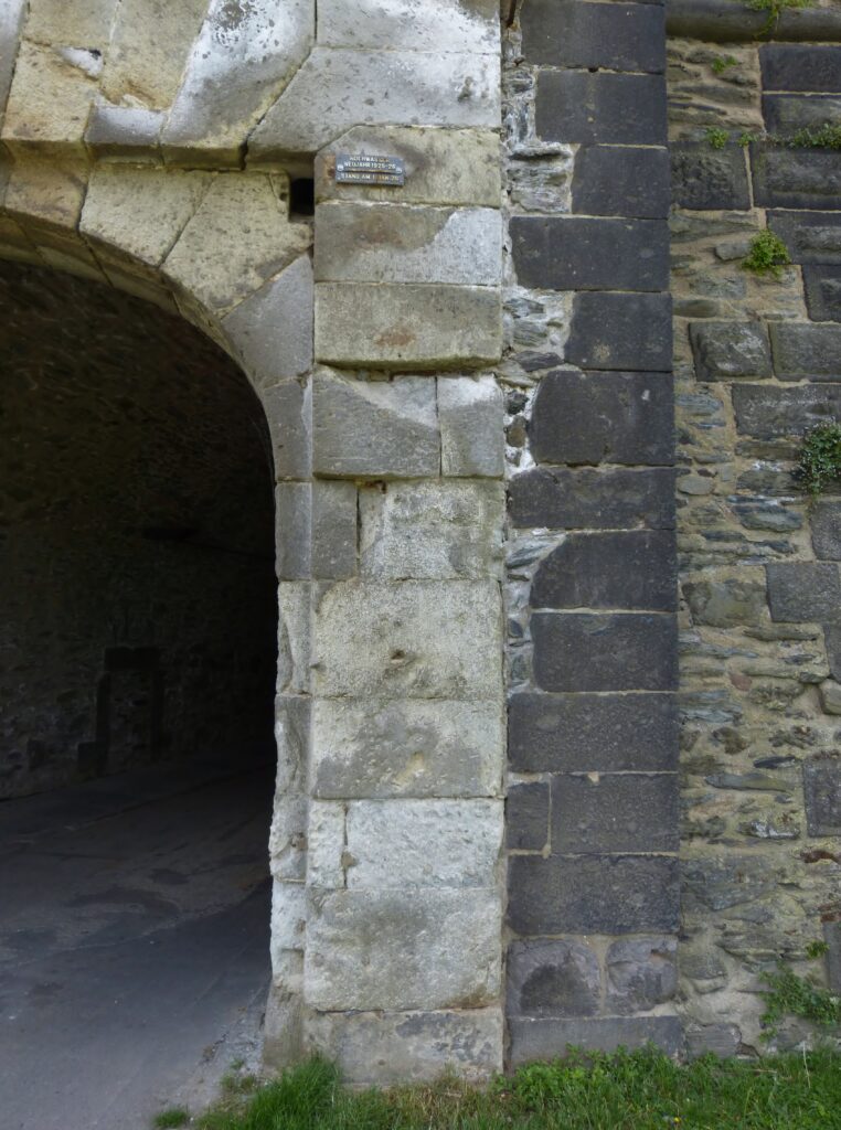
If you look above the arch and a little to the right, you’ll see a small plaque. The Rhine River is just to the right in this photo, and the plaque indicates the high water mark for the river in 1925/26. It’s well over 6 feet above ground level. I can’t imagine what these towns along the Rhine and other rivers are like when there is flooding like that.
If you’ve seen the Andernach Geyser or any other geysers around the world, tell us about it here or on our Facebook page!
https://www.facebook.com/travelsandtipples?ref_type=bookmark